
TAYLOR CANYON TRAIL
BONNEVILLE SHORELINE TRAILS, OGDEN, UTAH
LENGTH:
1.5 miles one way
ELEVATION GAIN:
1561 feet
HIGHEST POINT:
6447 feet
CALCULATED DIFFICULTY:
Moderate


TAYLOR CANYON TRAIL DESCRIPTION
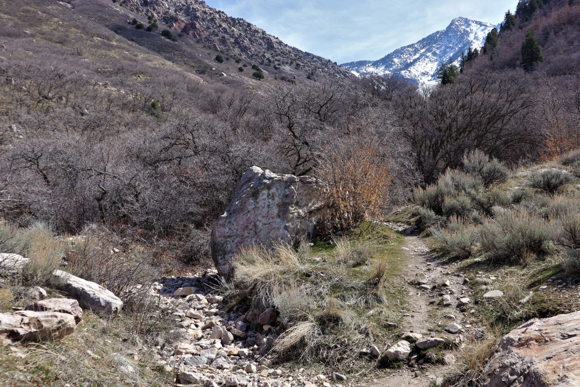
The Taylor Canyon trail is best known as the way to access the route to the summit of Malan’s Peak. Taylor Canyon is the major canyon between Ogden Canyon and Waterfall Canyon above Ogden’s east bench. The trail can be accessed from 27th Street or the 29th Street Trailhead. 27th Street is not a developed trailhead, but hikers and bikers may park along the street. Access to the Taylor Canyon trail from 27th Street can be confusing, however. The trail is not marked and there are multiple “social” trails in this area. At the end of 27thStreet, take a left and then a hard right to hike up the north side of the creek. About a quarter mile up the canyon, the rocky trail crosses the creek and continues up the south side. (In 2023, the creek was too fast and too high to safely make this crossing because of record snow melt.)
The trail on the south side of the river eventually reaches a bridge that takes the trail to the north side again. On the north side continue another quarter mile to reach the route to Malan’s Peak.
Pro Tip:
The 29th Street trailhead provides better access to Taylor Canyon as well as ample parking and a restroom. To reach the Taylor Canyon trail, hike east up the mountain until you reach a totem that directs you north to Taylor Canyon along an access road. Take the trail to the right where the access road heads down the mountainside to a fence. (The trail you are on will take you through another area of private property, but access is permitted.) The route to Taylor Canyon is well marked once you reach the junction of several bench trails with views of Ogden to the west.
TAYLOR CANYON TRAIL LOCATION
27th Street Trailhead: Follow 27th Street east, towards the mountains, and at the very end (top) of 27th Street there is some street parking and a gate.
29th Street Trailhead: Ogden’s 29th Street trailhead, located at the top of Ogden's 29th street, is a USFS trailhead and the nexus for several trails in the area including the Bonneville Shoreline Trail (heading both north and south) 36th Street Exercise Trail, and the Waterfall Canyon Trail.
From the trailhead parking lot, the trail immediately diverges either up the hill or south. The south branch is the 36th Street exercise trail which is popular with mountain bikers and joggers. This trail will take you past the golf course and to Strong’s Canyon.
If you head up the hill (East), you will reach the Bonneville Shoreline Trail (BST) in about .75 miles. If you go South on the BST, you will reach Strong Canyon in about 1.2 miles and can go onto Beus Canyon another 2 miles on the trail. If you go North on the BST, you will reach Taylor Canyon in about 1.5 miles and can go up Malan Peak from there. If you continue East up the canyon from this point, that is Waterfall Canyon and will reach the waterfall in about .75 miles.
The area is very popular for hiking and mountain biking. During the Winter and Fall, there aren’t very many people but during the summer the entire area is awash with mountain bikers and hikers. On some summer evenings the trail to Waterfall Canyon is quite busy.
GETTING THERE
This trail description is written by:
Ron Thornburg, TFNU Board Member


