
WATERFALL CANYON TRAIL
BONNEVILLE SHORELINE TRAILS, OGDEN, UTAH
LENGTH:
2.4 miles out and back
ELEVATION GAIN:
1275 feet
HIGHEST POINT:
6004 feet
CALCULATED DIFFICULTY:
Difficult


WATERFALL CANYON TRAIL DESCRIPTION
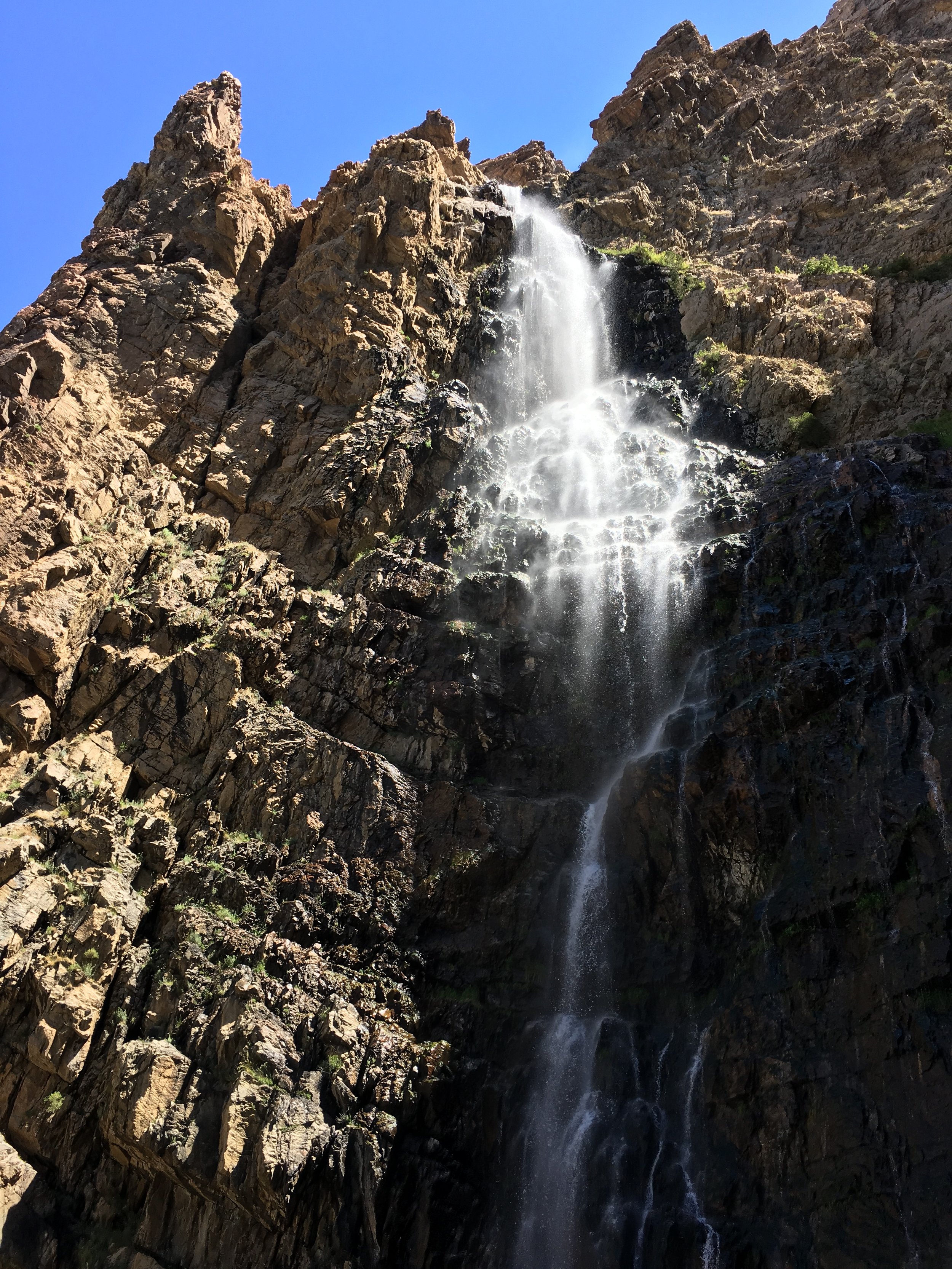
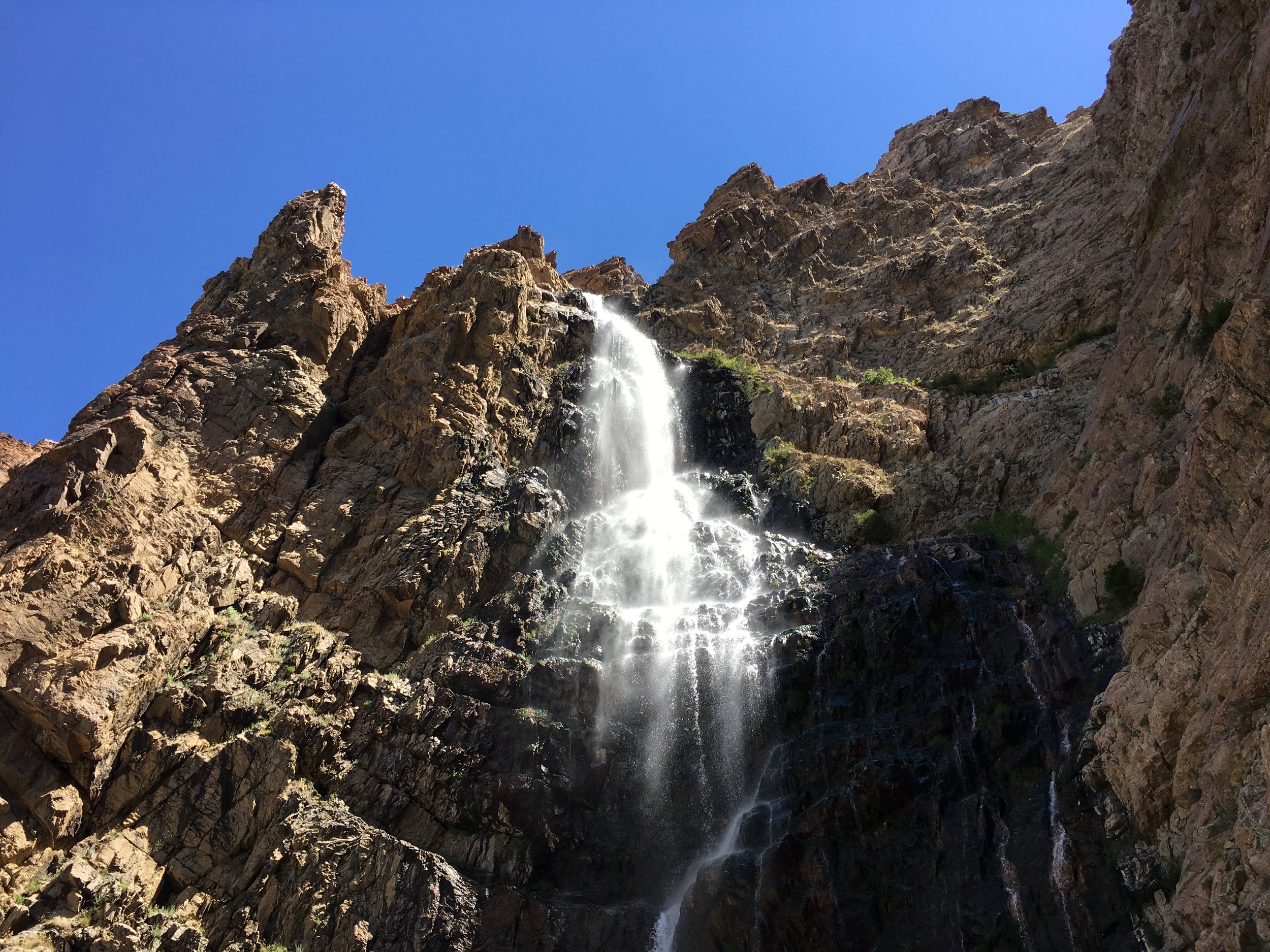
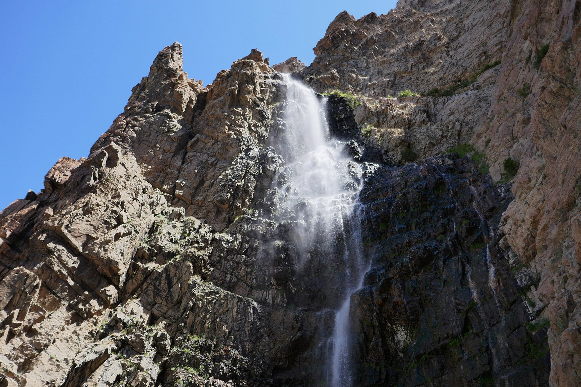
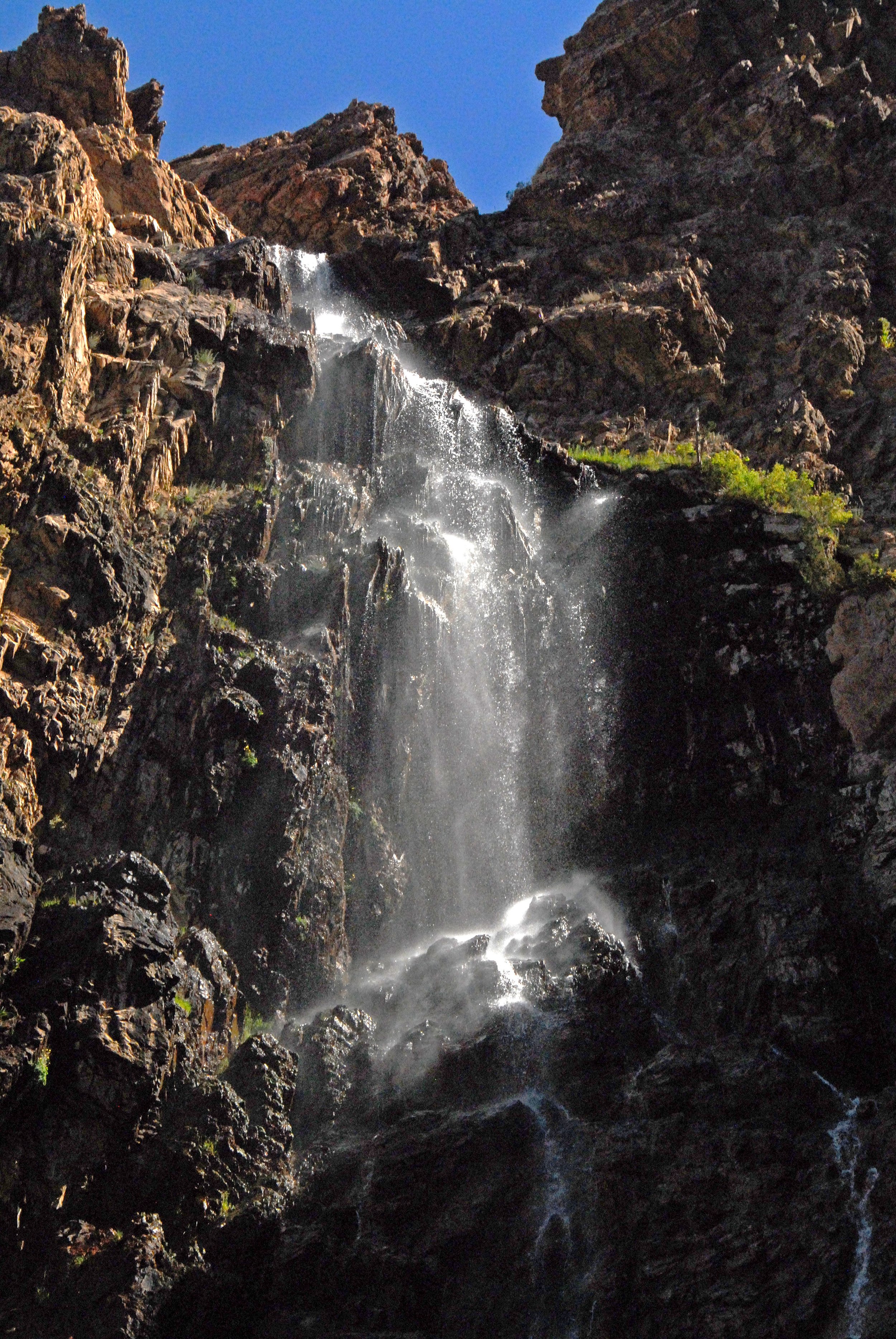
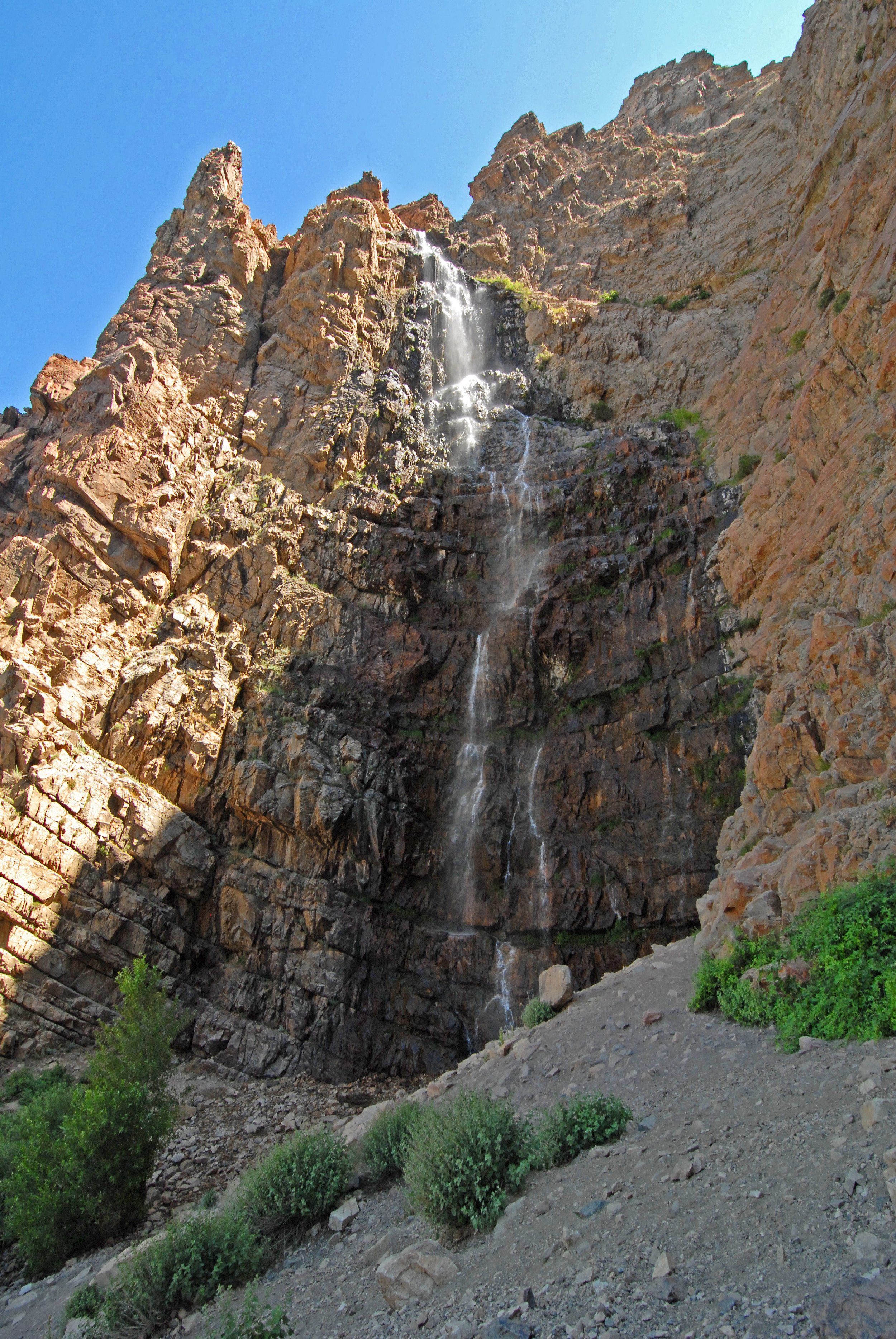
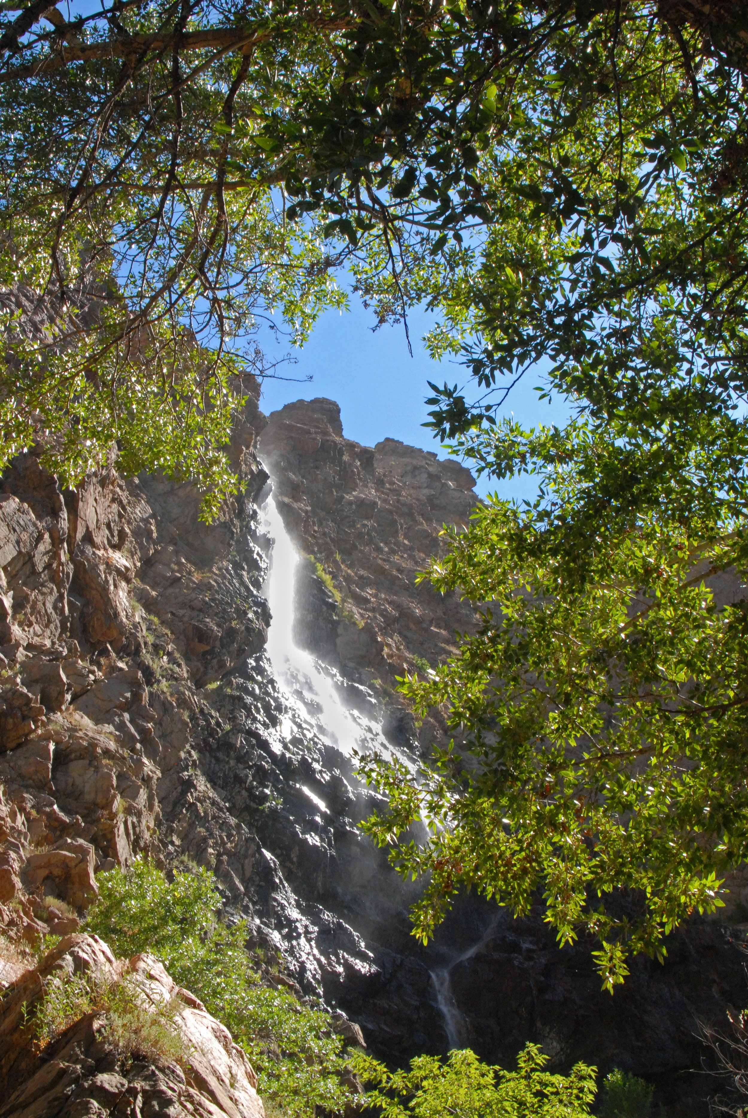
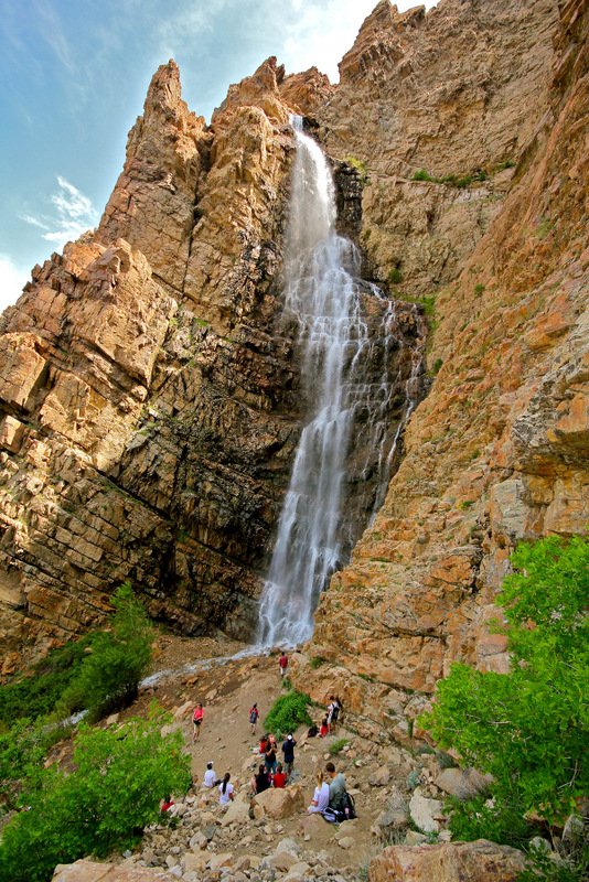
Waterfall Canyon is Ogden’s signature hike. Countless school groups, couples and families have made the short but strenuous hike for an opportunity to see a 200-foot waterfall cascade down a sheer cliff face.
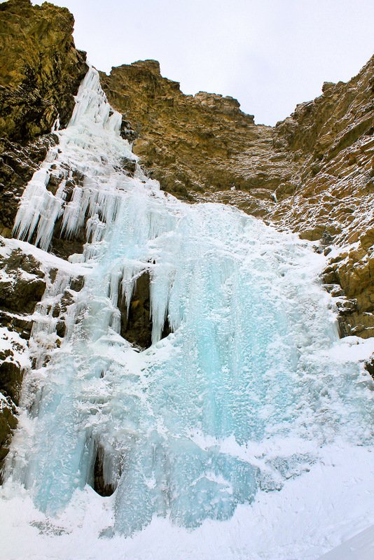
In spring and summer, the roar of the waterfall can be heard through the trees as hikers approach this area landmark. In winter, the waterfall freezes to create a crenellated curtain of white ice that hides the rocks behind it.
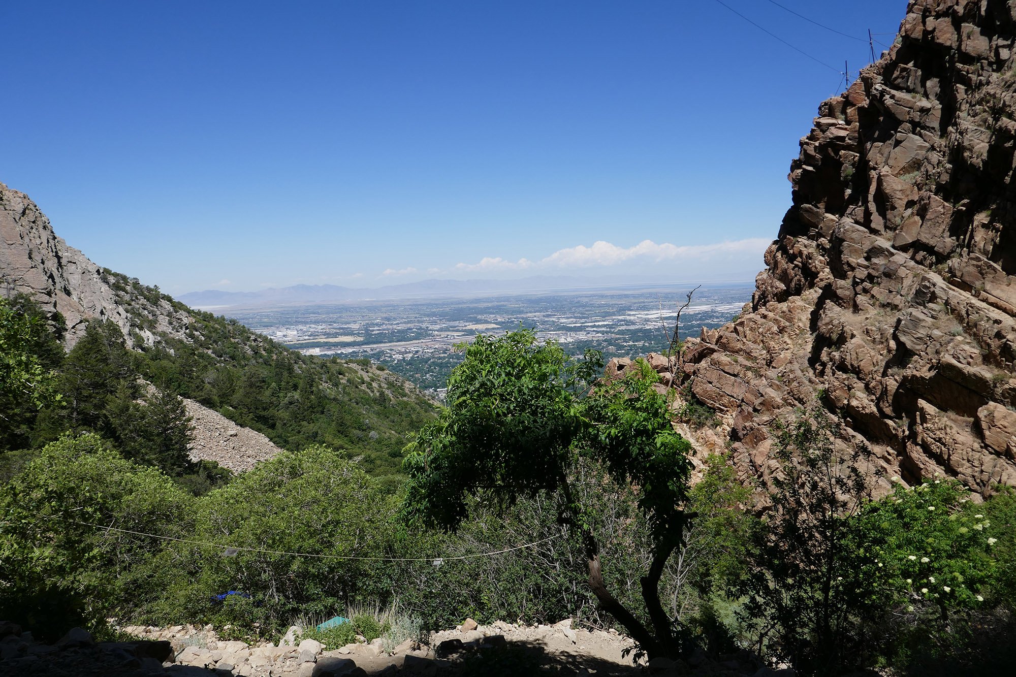
Most hikers begin their trip at the 29th Street Trailhead where they head east up the mountainside to a totem that indicates the route to Waterfall Canyon and the Bonneville Shoreline Trail (south).
Heading south from the totem the trail crosses onto private property owned by the TR Guest Ranch. Owner Chris Peterson asks that hikers respect his property by not littering and picking up dog waste.
About three-quarters of a mile from the trailhead the wide sandy path intersects the Bonneville Shoreline Trail. A wooden bridge across the creek is a great place to take a break and enjoy the view down the canyon before beginning the difficult hike back to the waterfall.
The trail to the waterfall begins just a few yards south of the bridge. Turn left and head east along the south side of the creek. After a short distance a second bridge will take you to the north side of the creek and you are on your way.
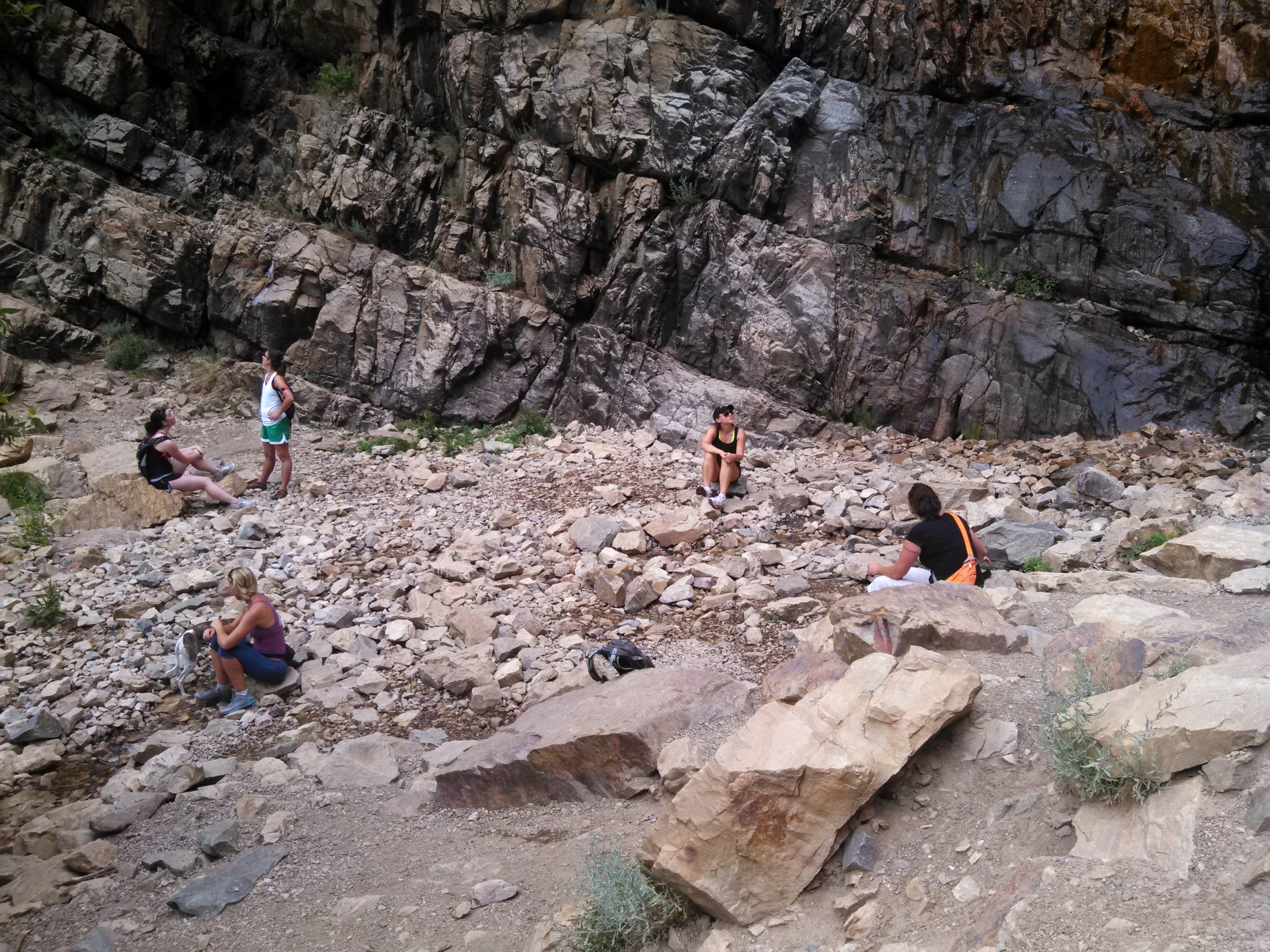
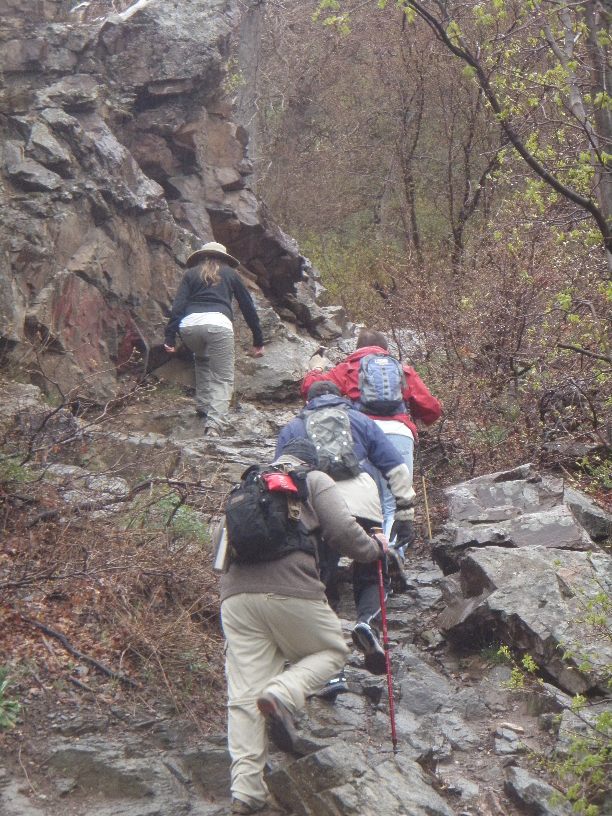
The remaining portion of the trail is steep and rocky, and children should be closely supervised. Many a sprained ankle or worse have occurred on this part of the trail.
The waterfall is approximately 1.2 miles from the 29th Street Trailhead and the last part of the hikes requires scrambling up loose rocks to get the best view.
Pro Tip:
On busy spring and summer weekends, several hundred hikers have been known to crowd the trail. In winter, the trail is seldom used but can become extremely icy and dangerous for hikers without the proper footwear.
WATERFALL CANYON TRAIL LOCATION
DIRECTIONS TO TRAIL HEAD
From Ogden