
OLD SNOWBASIN ROAD
WHEELER / ART NORD TRAILS, OGDEN VALLEY, UTAH
LENGTH:
3.2 miles one way
ELEVATION GAIN:
797 feet
HIGHEST POINT:
6283 feet
CALCULATED DIFFICULTY:
Moderate


OLD SNOWBASIN ROAD DESCRIPTION
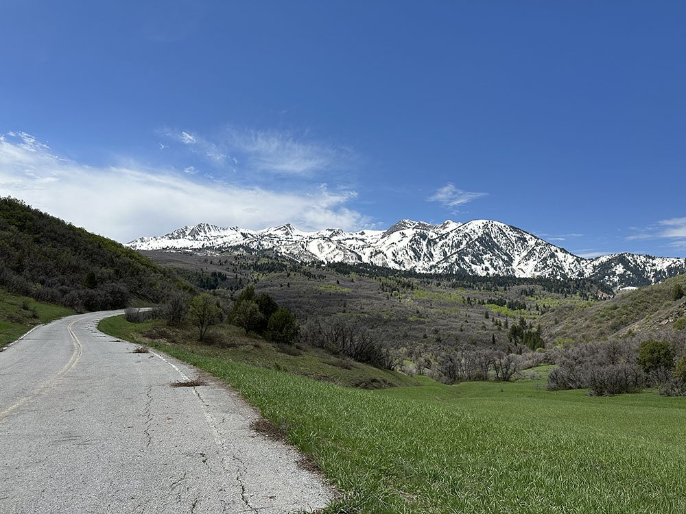
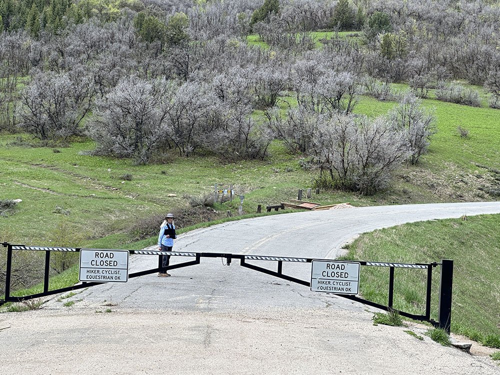
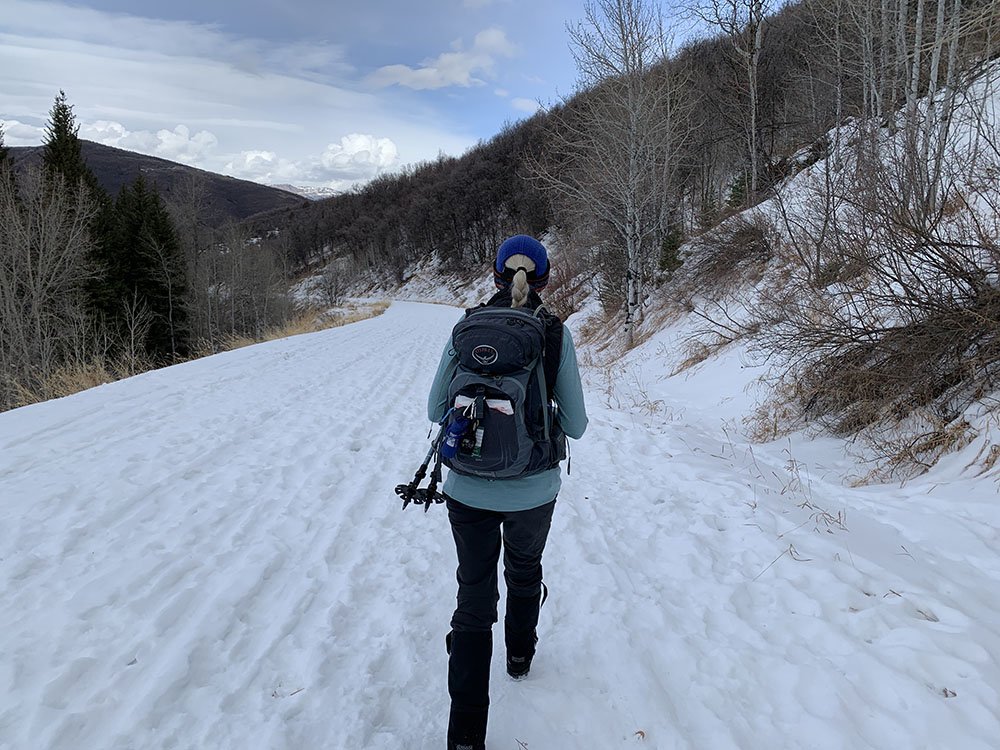
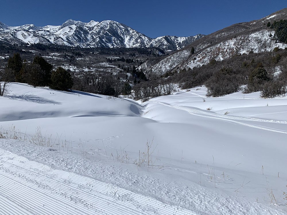
The Old Snowbasin Road can be accessed from either the Art Nord Trailhead or the gate just below the Snowbasin entrance with the flags. It is used by hikers, bikers and horses as it is always available regardless of the single-track trail conditions. Because of this it’s a great place for spring hikes, when the snow isn’t good enough to snowshoe and the trails are too sloppy to use. It’s also good in the wintertime for snowshoeing, cross country skiing, and fat tire biking as Snowbasin occasionally grooms it and if not, it still gets a lot of use, so it stays fairly well tracked out for snowshoeing and biking. It’s also easily usable by adaptive riders. The area near the Art Nord trailhead is really popular on the weekends in the winter for tubing, so the parking area can be very crowded. There are pit toilets at the Art Nord trailhead that are open year-round. There is access to the East Fork and Middle Fork trails off the Old Snowbasin Road. A nice 6-mile loop is to go up the Snowbasin Road to East Fork, up East Fork to Middle Fork, down Middle Fork to the Old Snowbasin Road, and then down the road to Art Nord. There are moose in the area, especially in the wintertime, when they usually sleep on the road. Although the road is not really steep, it’s a constant climb from Art Nord to Snowbasin.
This Trail description is written by:
Mike Appleby, TFNU Board Chair
OLD SNOWBASIN ROAD LOCATION
GETTING THERE:
From Ogden