
MULES SHOE TRAIL
NORTH FORK PARK TRAILS, OGDEN VALLEY, UTAH
LENGTH:
2.0 miles one way
ELEVATION GAIN:
121 feet
HIGHEST POINT:
5988 feet
CALCULATED DIFFICULTY:
Moderate


MULES SHOE TRAIL DESCRIPTION
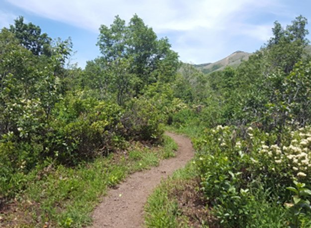
This trail drops you into a bowl regardless if you start at the beginning or end, so you’ll have to climb out either way. It can be made into a loop by taking the Connector trail (parallel to main road) or if adding Mule Ear as well (clockwise seems to be the more popular way to go). This trail can be shortened by adding Cinch. There are several streams and often moose. There are shady and non-shaded areas. Overall, it is a fun trail with a different feel from the others at North Fork park.
MULES SHOE TRAIL LOCATION
DIRECTIONS TO TRAIL HEAD
From Ogden, get onto 12th Street and head towards the mountains (east). 12th Street turns into UT-39, otherwise known as Canyon Road. You will go about 6 miles through the canyon and eventually see the dam for the reservoir. At this point, turn left over the dam onto UT-158 N. In about 4.3 miles you will come to a fork in the road - bear left onto N. Highway 162, which you will stay on for about 2.4 miles. Merge onto N. 3500 E for about half a mile and then turn left onto E. 4100 N. for about a quarter of a mile until you see N. 3000 E. where you will make a right. In about a mile and a half you will bear to the left onto North Fork Road. Stay on North Fork road for about 2.5 miles and then turn left onto E. 6890 N. and continue for about a half mile. Bear left onto North Fork Park Road and in about a half mile, the trailhead will be on your left.
This trail description is written by:
Michelle Paustenbaugh, Board Member